The city
Saxon Brașov: a Short History of Kronstadt, and How to Read It in the Streets
Tony Denesa – Travel Advisor9 min read
A city with three names
Stand in Piața Sfatului and you are in a city that has answered to three names for most of its history: Corona in Latin, Kronstadt in German, Brassó in Hungarian — and Brașov in Romanian. The crown on an oak trunk with roots, the city's coat of arms, is carved over the old gates. For seven centuries the people who built these walls, churches and guild houses were the Transylvanian Saxons, and although only a few thousand of their descendants remain in the region today, Brașov is still, visibly, the city they made. This is a short history of Kronstadt, and a guide to reading it in the streets.
The knights and the settlers (1211–1300)
In 1211 King Andrew II of Hungary granted the Teutonic Knights the Bârsa Land — the Burzenland, the fertile basin ringed by mountains where Brașov stands — to guard the south-eastern frontier of his kingdom. The knights built fortifications and brought settlers, but they were too ambitious for the king's taste, and in 1225 he expelled them. The settlers stayed.
They were German-speaking colonists, mainly from the Rhine and Moselle lands, known collectively as "Saxons" although few came from Saxony. The first written mention of the area as a Saxon land, *Terra Saxonum de Barasu*, dates from 1235. The oldest building still standing in Brașov is theirs: St Bartholomew's Church, built between about 1225 and 1260 in the old settlement of Brașovechi, early Gothic with Romanesque bones.
The merchant city (1300–1500)
Kronstadt grew rich on trade. It sat where the routes from Wallachia and Moldavia crossed into Transylvania and on towards Central Europe, and its merchants handled everything from cloth and metalwork to spices and wax. Royal privileges gave the city a strong hand over the goods passing through; the Saxon community governed itself through its own council and elected officials.
That wealth paid for the great church on the main square, begun in 1383 and completed around 1477 after interruptions — including an Ottoman raid in 1421. It is the largest Gothic church in this part of Europe, about 89 metres long, with a 65-metre tower. Today we call it the Black Church, a name it acquired only after the great fire of 1689.
Walls, bastions and guilds
Kronstadt was never a lord's town; it was a burghers' town, and it defended itself. From the 15th century the citizens wrapped the centre in a ring of walls, with towers and bastions each maintained by a guild — the weavers, the blacksmiths, the ropemakers, the tanners, the goldsmiths. Walk the promenade under Tâmpa, Strada După Ziduri, and you are walking along those walls.
- The Weavers' Bastion is the best preserved, and now houses a museum of the city's fortifications with a scale model of 17th-century Kronstadt — the single best introduction to the old city.
- Graft Bastion, built between 1515 and 1521 over a stream, and the White Tower and Black Tower on the hillside above, give the classic views over the roofs.
- Catherine's Gate, built by the tailors' guild in 1559, is the only original city gate to survive. Its four corner turrets signalled that the city had *ius gladii* — the right to judge and execute.
- Strada Sforii, the famously narrow Rope Street, was a firefighters' passage in the 17th-century city.
Honterus and the Reformation (1530s–1540s)
Kronstadt's great intellectual figure is Johannes Honterus (1498–1549), a humanist scholar born in the city who studied and worked in Kraków and Basel before returning home to transform it. In 1533 he founded a humanist gymnasium — the school that still bears his name next to the Black Church. In 1539 he set up a printing press, and in 1542 he published the *Rudimenta Cosmographica*, a geography textbook that went through dozens of editions across Europe. Above all, Honterus led the Lutheran Reformation among the Transylvanian Saxons; the Black Church has been a Lutheran church ever since. His statue stands in the churchyard.
The other Brașov: Șchei and the Romanians
The Saxons were not alone. Romanians lived outside the walls, mainly in Șchei, the valley quarter to the south-west, which paid its own taxes and entered the city by its own gate. Their spiritual centre was the Church of St Nicholas, whose stone church was begun in 1495, and beside it stands the First Romanian School, where in the 16th century the deacon Coresi printed some of the first books in the Romanian language. The Junii, the young horsemen of Șchei who still parade through the city each spring, are part of this story. Hungarians and, later, a Jewish community added further layers; our Șchei area guide explores the Romanian quarter.
Fire, empire and a new country
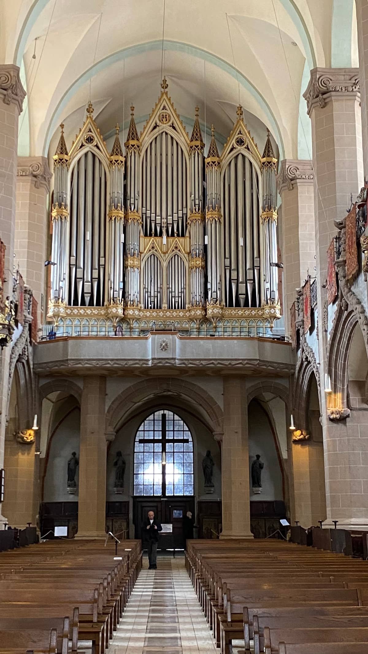
On 21 April 1689, during the upheavals that brought Transylvania under Habsburg rule, a great fire swept through Kronstadt, blackening the walls of the main church. The city rebuilt; the 18th and 19th centuries added baroque and neoclassical façades to medieval plots, and the Council Square took its present shape. The great Buchholz organ of the Black Church was inaugurated in 1839. After 1918, Brașov became part of Romania, and the Saxons a minority in a new state.
The twentieth century and the long goodbye
The Second World War and its aftermath were devastating for the Saxons. In January 1945 thousands of ethnic Germans from Romania were deported to labour camps in the Soviet Union; under communism, property was expropriated and villages collectivised. After 1989, freedom to leave became a mass emigration to Germany, and the Saxon population of the region fell to a small fraction of what it had been. Their story in the 20th century intertwines with the city's communist years — told in our history of communist Brașov and the 1987 revolt.
Reading Kronstadt today
Start at the Black Church and look at the south side, where the buttresses still carry statues and the walls still show the soot of 1689. Walk to the Weavers' Bastion for the model of the old city. Climb to the White Tower at dusk. Then leave the city: the fortified churches of the Bârsa villages, Prejmer and Hărman, and the deeper Saxon country around Viscri, show the rural half of the same civilisation. Our old town guide maps the walk.
Where to stay nearby
Live prices and availability on a map centred on this exact spot — hotels, apartments and hostels, so you can judge the walk from here rather than guess from an address.
Bookings made through this map earn us a commission. Your price is unaffected.